
PlaceFinder


HOME /
Foxley River, an unincorporated area, is located in Prince County in the western portion of Prince Edward Island, E. of O'Leary. Its precise location is N 46°42', W 64°01'.
This page is a comprehensive index of all of the information on our website related to Foxley River. You can also search for information on other communities.
| Aerial Photographs |
Aerial photography courtesy of AirScapes. All aerial photographs are available for sale, as prints or slides; please contact AirScapes for details. You can also see a complete list of aerial photographs of the Island.
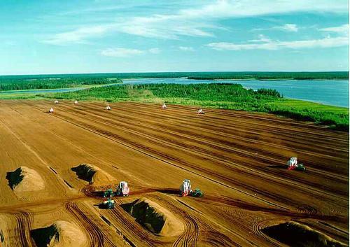
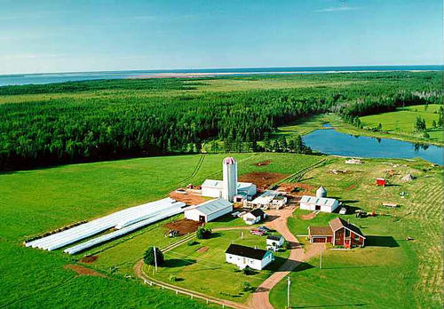
 | Peat harvesting 710 x 502 - 44K 500 x 353 - 48K |  | Farm 710 x 495 - 49K 500 x 348 - 53K |
| Visitors Guide Listings |
Our Visitors Guide is a complete vacation planning manual.
| The Geography of Foxley River |
Maps
You can use our interactive maps to
display maps of Foxley River and area.
Click on the map link:
Show Map
| Statistical Information |
Foxley River falls inside the Statistics Canada
census subdivision of Lot 11. They have detailed statistical information available
for the Lot 11 census subdivision for the following categories:
Education,Ethnicity,Family,Income,Labour Force,Population, and Shelter.
Information courtesy Statistics Canada.
| History of the Name |
The official history of the geographic name Foxley River (which can be somewhat technical, we admit):
Foxley River (Sett.) was adopted 3 December 1946 on 21I/9.Status changed to Locality in 1960 Gazetteer.Status confirmed as a Locality when Foxley River became part of the Community of Lot 11 and Area in 1982. Probably after Henry Fox, first Baron Holland of Foxley.He died in 1774.- PN of PEI, 1925.Samuel Holland named the nearby river after this man in 1765 - Georg. Names of PEI, 1973.
Information courtesy Geomatics Canada .