|  |
| Larger Image (451.2 KB) |
| Acc2320/6-4 |
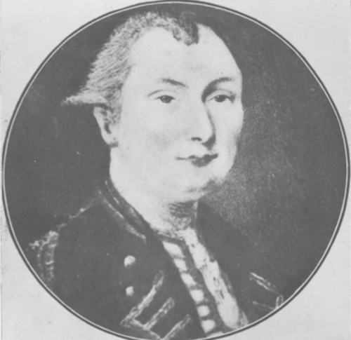
| Samuel Holland |
| |  |
| Larger Image (315.5 KB) |
| Acc2320/6-5 |
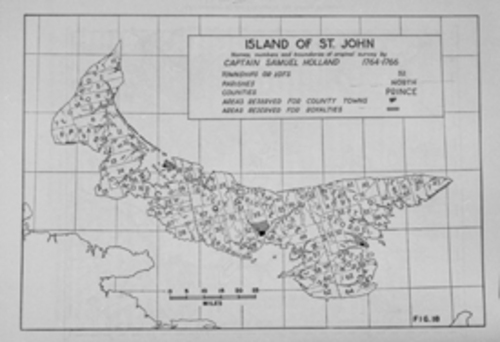
| Island of St. John showing the 67 lots as laid out in Holland's survey |
| |
Captain Samuel Holland was tasked by the British Crown with surveying the Island of St. John. His 1765 map divided the Island into 67 townships or lots, identified counties, and designated county capitals, including the provincial capital Charlottetown.
To celebrate the 250th anniversary of Hollands survey, the original Holland Map was brought back to PEI in 2015 and formed the basis of Imperial Designs: Samuel Holland's 1765 Map and the Making of Prince Edward Island, an exhibit at the Confederation Centre of the Arts. | | Next>>> | | Previous<<< |
|
| Return to Exhibit Listings |
|
| To see more of the images from this and other collections visit the Public Archives and Records Office, Atlantic Technology Centre (ATC), 176 Great George Street, Suite L20, in Charlottetown, Prince Edward Island. | For more information about the Public Archives and its holdings, please visit princeedwardisland.ca/en/topic/libraries-and-archives.
|
|


