|  |
| Larger Image (84.8 KB) |
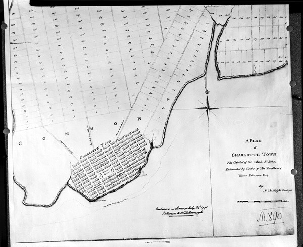
| PARO Acc. 0,534 |
| Lot Plan of Charlottetown, [1771?] |
| |
| In 1768, "Charles Morris of Nova Scotia began laying out the streets of Charlottetown. Thomas Wright, a surveyor, expanding upon Mr. Morris's plan, created a layout of the town with 500 lots, a central square for public buildings and four large green squares." Many changes have taken place within the city over the years; however, the original 500 lots are still recognizable and the four green squares still exist. The Wright Patterson 1771 Plan of Charlottetown is essentially the plan drawn by surveyor Thomas Wright. Source: City of Charlottetown portal http://www.city.charlottetown.pe.ca/learning/city_history.cfm | | Previous<<< |
|
| Return to Exhibit Listings |
|
| To see more of the images from this and other collections visit the Public Archives and Records Office, Atlantic Technology Centre (ATC), 176 Great George Street, Suite L20, in Charlottetown, Prince Edward Island. | For more information about the Public Archives and its holdings, please visit princeedwardisland.ca/en/topic/libraries-and-archives.
|
|


